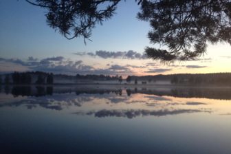

The Pyhäjärvi-Lakeaharju Hiking Trail offers lake landscapes in terrains of Lappajärvi, a crater lake created by the impact of a meteorite about 76 million years ago. The crater is surrounded by a bench rising to 100 m from the surface of the lake on the south-eastern shore of the lake, as a hogback consisting of the hills of Lakeaharju and Pyhävuori. When seen especially from the rocky top of Pyhävuori, the landscape of Lappajärvi is very steep by South Ostrobothnian terms. The trail, passing along crests and in varying forest landscapes, visits at Kellaripuro the bottom of a brook carved in the soil of the sand heath at the end of the Ice Age.
To the starting point of the trail
Starting point 1
Eastern starting point/endpoint of the trail
Lakeaharju (Vimpeli)
Extension of Mäkeläntie Road (when arriving from Alajärvi), extension of Sepentiinintie Road (when arriving from Vimpeli)
(WGS84) N63° 5.67392′ E23° 49.66988′
Starting point 2
Western starting point/endpoint of the trail
Lakeaharju (Alajärvi)
Turnaround of the forest road on the top of Pyhävuori There is a large information board with a map and information at the starting point (WGS84) N63° 4.67411′ E23° 44.15897′
Starting point 3
In the middle of the line segment route
Kellaripuro (2 km from Pyhävuori in the direction of Lakeaharju).
When the trail crosses Pyhälahdentie Road (Pyhälahdentie 826)
(WGS84) N63° 4.59656′ E23° 45.46821′
Trail description
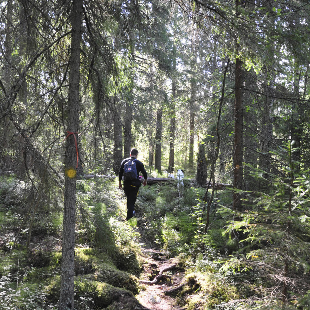
The line segment trail of Pyhävuori-Lakeaharju passes through a varied forest terrain. The length of the trail is 6.7 km in one direction; back and forth 13.4 km. The recommended direction for walking the trail is from Lakeaharju to Pyhävuori; in that case, the most impressive and varied destinations are close to the end of the trail. Yet, the line segment route can be walked in both directions. The trail is marked with yellow spots painted on trees. In some places, the yellow spots are painted on the landmarks. The intersections and road crossings are signposted, and the signposts mostly indicate the distances. There are some places for a campfire along the trail, and one lean-to. The lean-to is located at 2.6 km from the starting point of Lakeaharju.
Level of difficulty
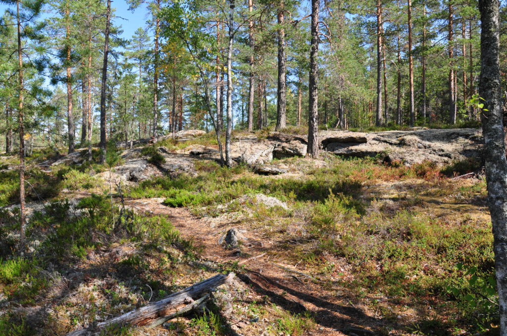
The trail passes through a varied forest terrain, mainly along paths. The terrain mostly consists of dry heath and rocks. The track is easy to walk on. There are a few somewhat steeper thresholds and ascents along the trail, but, on the rocks, they have been equipped with stairs, small bridges, and ropes. The trail is suitable as a day-trip destination for hikers in normal physical condition accustomed to walking in nature.
Good to know
Making a fire on Pyhävuori is prohibited. You must bring along your own firewood to the places for a campfire along the trail, but the lean-to is equipped with firewood. There are no toilets along the trail. The Leave No Trace policy is followed in the area, which means everyone takes their own rubbish away. As a rule, mobile phones have good coverage in the area. Stout shoes suit the trail best, although lighter shoes are sufficient during dryer weather. Otherwise, dressing normally for weather is sufficient. The trail is passable when there is no snow. The trail includes several crossings with forest roads and other roads at a distance of about one kilometre, and so you can walk legs of different length depending on your interest and condition.
Environment
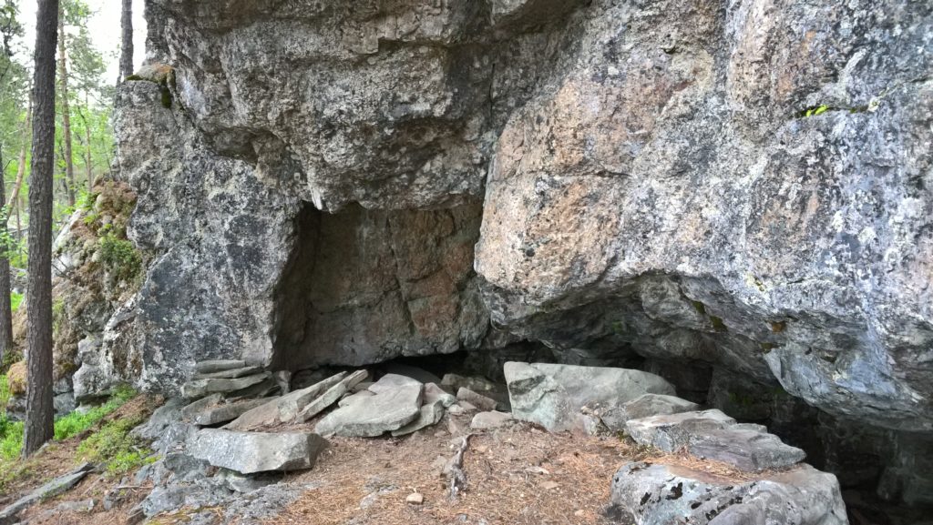
When walking from east to west, the trail starts from the jogging track of Lakeaharju and enters a heath forest with pines. The landscape consists of conifer-dominated commercial forest, but on occasions there are deciduous trees. In Hirmukorpi, the landscape of the trail is vivified by an old spruce forest and a small hollow with a ditch. The lean-to offers the first view of the landscape of Lake Lappajärvi. The bare rock area starting from the lean-to represents the external zone of the crater lake. If you look carefully, you can find good examples of rock types, their forms and details, as well as of different types of erosion of rocks. After the barren and rocky heaths, the Kellaripuro brook is a shady and lush place. Kellaripuro has carved a steepbanked bed in a sandy ridge. The highlight of the trail is Pyhävuori, the south-eastern top of the marginal deposit of Lake Lappajärvi, which rises 148 m above sea level. Lappajärvi is 80 m below it. On the slopes of Pyhävuori, there are fine precipices and rock shelves, as well as shingle beaches, though not exactly along the trail. Pyhävuori also features plenty of small fracture caves, the longest of which is Pirunpesä (16 m).
Interesting information about the trail
The rock formations between Pyhävuori and Lakeaharju have mainly been assessed as nationally valuable or very valuable rock areas. Geologists have discovered at Lakeaharju a sea-stack, or a rock weathered by ice and water, and talus and fracture caves. Lake Lappajärvi, of 22 km in diameter, is the largest crater lake in Europe and the youngest, most famous, and best studied impact crater in Finland. There are plenty of tar-burning pits in the forests of the area, though not exactly along the trail. The name Kellaripuro (‘Cellar Brook’) refers to the air in the hollow, which is fresh and humid in the summer, too. Below, by the brookside, there is a meadow called Riitaniitty (‘Quarrel Meadow’), which reveals that gifts of nature have caused disputes. The more recent culture of Pyhävuori is represented by the fire guard’s lookout tower. On Pyhävuori, you can also see the ruins of Jaakko Reipakka’s (1855–1932) hermitage, or walls built from rocks at the foot of the precipice and around the cave. Pyhävuori has a strong position in the regional folklore, according to which the caves have been inhabited by trolls. According to tradition, Birkarlar had sacrificed Laplanders’ children on a special rock formation (Uhrikivi, Siankärsäkivi). It is believed that Pyhävuori has always played an important role in the life and believes of the local people.
Download and print the route description and map here!